Conservation study sights recreational boating on Flathead River
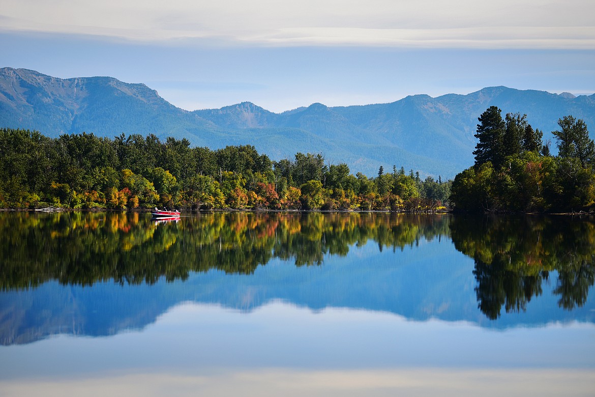
A fishing boat glides along the glassy surface of Church Slough along the Flathead River. (Casey Kreider/Daily Inter Lake FILE)
Flathead Valley conservation officials Monday will release a request for proposals to gauge how recreational boating impacts the increasingly crumbly riverbanks of the lower Flathead.
The erosion study coincides with a thrice-tipped joint resolution passed last year by the Montana Legislature to compile existing data on erosion along the Flathead River; ferret out impacts from recreational watercraft; and recommend how to control erosion along its alluvial banks.
In a related effort, the Flathead Conservation District this summer aims to firm up data specific to how — or even if — recreational boating drives erosion along more than 20 popular river miles above an ailing Flathead Lake.
Sediment from erosion is loading into the seemingly crystal clear waters of the largest natural freshwater lake of the West, albeit dammed, with the algal steroids of nitrogen and phosphorus.
Flathead Lake retains its brilliant clarity otherwise via the lack of such nutrients.
The lake has had a watershed restoration plan in place since 2014, courtesy of the nonprofit Flathead Lakers. Sediment loading remains a major target among myriad pollutant sources.
The conservation district — not concerned with creating erosion control measures with its new study — will submit findings to the state’s Water Policy Interim Committee, which is charged with carrying out the 2021 joint resolution on Flathead erosion, known simply as SJ 28.
Bank erosion along the river remains as old as the freshet itself, though federally mandated fluctuations in Flathead Lake levels — raised during summer months to better float recreation during peak tourism — lay the root cause to added erosion along the river.
The Confederated Salish and Kootenai Tribes’ Energy Keepers Inc. cooperatively maintains Flathead Lake levels per federal licensing requirements at Seli'š Ksanka Qlispe' Dam, the 200-foot-tall structure completed in 1938 as the John H. Kerr Dam.
The tribes acquired the dam in 2015.
Fluctuating lake levels, however better for recreation, flood out otherwise erosion-resistant vegetation growth during summer along the lower Flathead’s banks.
The lack of vegetation then creates a 9- to 10-foot “dead-zone” along the river’s banks, coinciding with levels at which the lake is raised and lowered, thereby exposing soils to regular flushes of water when the lake is lowered.
Samantha Tappenbeck, interim resource conservationist for the Flathead Conservation District, said during a pair of meetings this past week that recreational boating anecdotally has been fingered to further drive bank erosion along the resulting lake-like mainstem of the river.
On Thursday, the conservation district unanimously approved its request for proposals for release Monday in hopes of securing a contract by the start of peak boating.
Erosion work now required by SJ 28 is set to conclude before Sept. 15 for review next year during the state’s 68th legislative session. Montana House and Senate members convene every two years for legislative work, with 2022 being an interim study session.
And study they will. Many factors affect streambank erosion.
“The takeaway, really, particularly from a landowner perspective, is that there is no simple solution to this issue,” Tappenbeck told the Flathead Basin Commission on Wednesday.
“There are a lot of factors that contribute to erosion,” she said. “But now, there’s this added question, a relatively new factor that’s potentially driving erosion. … Now we’re seeing a really big uptick in recreational boating.”
Contributing to losses in riverfront agricultural and residential lands, erosion overall is being progressed beyond its natural cycle, Tappenbeck said, adding that comparatively calmer river waters create ideal boating conditions for recreationists than found on the lake.
“It is a natural process,” Tappenbeck said Wednesday. “Erosion is just the transport of sediment by physical force, so that physical force might be wind, it could be river current, or river flow, and potentially waves, as well.”
“It is an extremely powerful and relentless force that is going on all the time,” she said. “Nature provides a simple and elegant solution to the problem of erosion; that comes in the form of natural vegetation in the riparian buffer around the stream or river corridor.”
Citing a 2010 study by the Flathead Lake Biological Station, Tappenbeck noted a combined roughly 20 miles of shoreline, spanning either side of the river, was deemed either moderately or severely eroded.
Nearly 10 miles of shoreline lacked erosion, and another nearly 10 miles had rip-rap installed to help stabilize the banks — including the frowned upon Detroit method of securing old vehicles to the banks.
But, “this was 12 years ago when we did this study,” she said.
Current permitting data indicate streambank stabilization projects have waned significantly from a peak of more than 30 projects in 2004, up from about five in 1990 and 2021, respectively.
Estimated boat use on the river, meanwhile, more than quadrupled from 1992 to 2008, when Fish Wildlife and Parks completed the use study that also implicated boats in causing erosion.
“The study concluded that there is likely a direct connection between that increase in boat use and accelerated rates of erosion that we’re hearing landowners complain about,” Tappenbeck noted Wednesday during the Flathead Basin Commission meeting.
“We don’t have a great or complete picture of what boat use is looking like now, over the past 12 to 14 years,” she said. “No doubt, the boating numbers have gone up.”
She also pointed to recent data from FWP’s aquatic invasive species check stations that show a stark uptick in the estimated number of boats destined for the river — although not specific to its mainstem — with nearly 900 vessels overall hitting the river last July during peak boating.
The river’s headwaters emerge from the MacDonald Range of British Columbia. The Flathead then drains some 8,500 square miles of basin en route to its terminus at the Clark Fork River.
Along the way, the Flathead is loaded with erosion-born sediment that ultimately loads elemental nutrients like phosphorous and nitrogen into Flathead Lake, which remains listed as an impaired waterbody.
Impaired waterbodies fail to meet state water quality standards.
Threatened by sediment, the mainstem of the Flathead from Columbia Falls to the lake is considered a “stream of concern” not yet listed by the state as impaired, according to the Flathead Conservation District.
Tappenbeck said Wednesday that state water quality data indicate bank erosion accounts for 20% to 30% of suspended solids — the result of sediment — within the river, accounting for some 60% of estimated nutrient loading there.
“So that’s all dumping into the river, and then of course that river is flowing downstream and ultimately, emptying into Flathead Lake,” she said.
Among other noxious issues, too much of either nutrient leads to excessive algal blooms that in the extreme, could cause lake eutrophication, where lake oxygen levels become unable to support aquatic life.
On dry land, the lake and river also serve as a major lifeblood.
Economically, both contribute an estimated more than $20 billion in overall human benefits, according to SJ 28, from water supply to drought and flood mitigation.
Nature-based tourism on the waters are pegged for some 20% of the valley’s nearly $8 billion local economy, the resolution notes.
It called for collaboration among several stakeholders in addressing Flathead River erosion.
Those include the Flathead Conservation District, Flathead River Commission, Flathead Basin Commission, Fish Wildlife and Parks, the Confederated Salish and Kootenai Tribes, the National Park Service, cities and towns within the basin, and at least two public members from recreational and agricultural entities.
Final results and recommendations, if any, will be reported next year during the 68th Montana Legislature.
Reporter John McLaughlin can be reached at 758-4439 or jmclaughlin@dailyinterlake.com