Dangerously warm temperatures create ‘magnificent’ avalanches

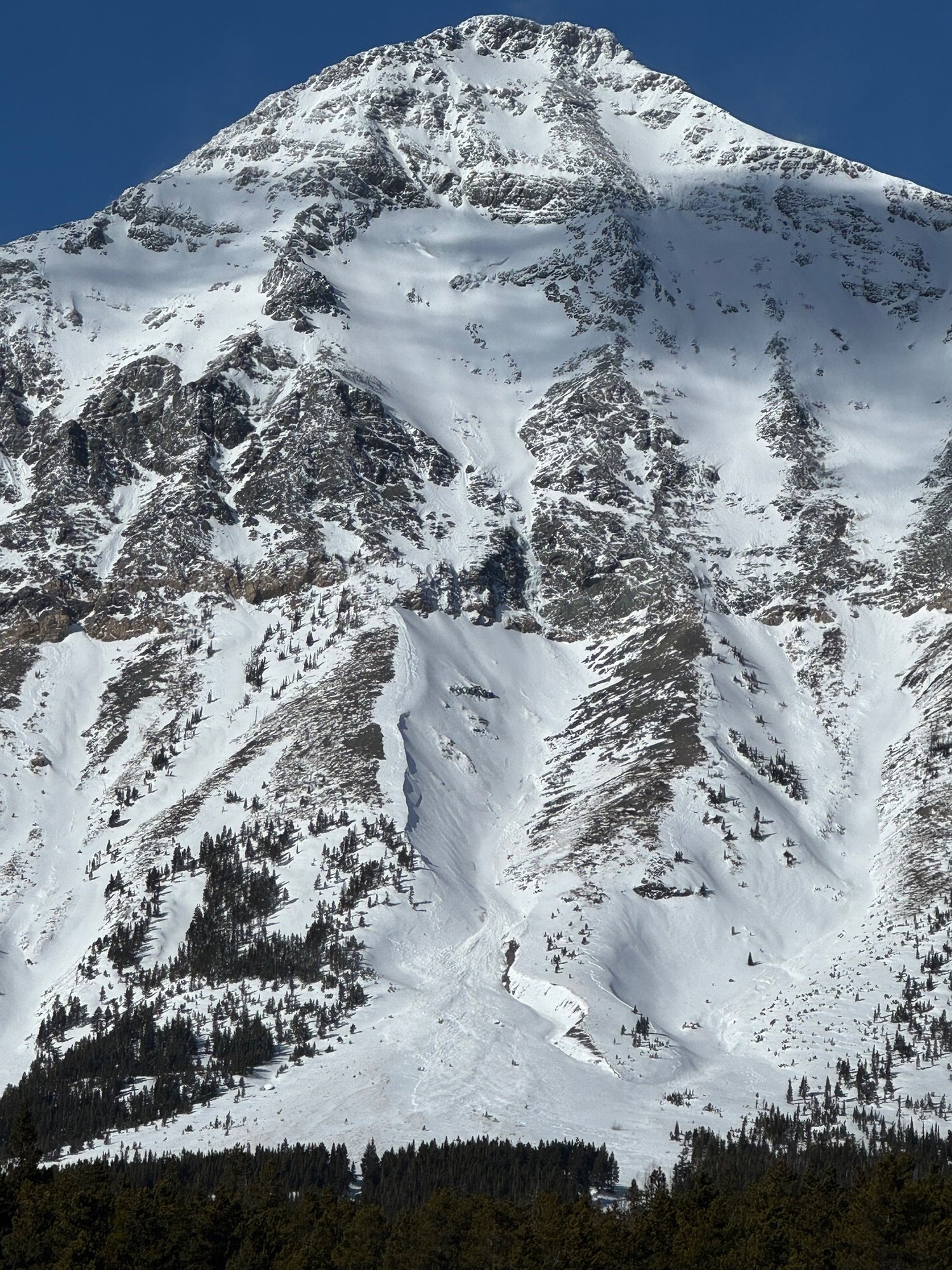
Sheep Creek Headwall, R4D4 avalanche observed by Glacier National Park Snow Ranger Jackson George on Feb. 24, estimated to have occured on Feb. 23. (Jackson George Photo via Flathead Avalanche Center)

A D3 avalanche on Little Dog Mountain observed on Feb. 24. Photo by Jackson George.

Avalanche on Stryker Ridge in the Upper Whitefish Range. Photo by Grant Hughes with Great Northern Powder Guides.

A user submitted photo on Flathead Avalanche of instability on a snowmobile trail in the Whitefish Range near Red Meadow Lake on Feb. 22.
A drastic winter thaw has created dangerous avalanche conditions in Northwest Montana as temperatures rose to the mid-40s and rain and snow fell over the weekend.
“In the wake of this weekend’s atmospheric river, many destructive avalanches decorated the mountains,” observed Glacier National Park snow ranger Jackson George during a driving assessment Monday, Feb. 24.
George observed dozens of slides, which he described as large to very large in size, and one was “historic.”
“Today's grand prize goes to the southern Flathead Range,” George wrote, “with an undeniably destructive and tremendously impressive slide that reached at least 3/4 of a mile across the Flathead Crest/Sheep Creek headwall.
“This deadly beauty appears to have had humble beginnings as a very large wind slab that battled its way to victory by successfully unstitching and unloading a D4 persistent slab in the basin below. It was an honor to observe this magnificent slide,” George wrote.
Flathead Avalanche Center observer Mark Dundas noted 20-25 crowns of soft slab avalanches on north, east and south aspects at mid and upper elevations in the Flathead Range bordering Glacier National Park near Rescue Creek and Nyack Mountain.
As visibility cleared, BNSF Railway's avalanche patrol observed 12 slides near John F. Stevens Canyon on Feb. 24.
In the northern Whitefish Range near Olney, Grant Hughes with Great Northern Powder Guides observed that “about half of the historic paths that I could visually identify had slid sometime in the last 24 hours.”
“Crowns were often at mid-elevations leading to less than historic runouts but some impressive ones nonetheless. The heavily logged areas around Stryker Ridge had some decent sized slides,” Hughes noted.
The numerous avalanches observed Feb. 24 were no surprise following multiple reports of instability and cracking across Flathead and Whitefish ranges Feb. 21-23.
A Feb. 21 public observation in John F. Stevens Canyon submitted by backcountry skier Kyle Bitney stated, “Between the poor snow quality, the low snowpack and the mega boosh, we had an infamous Middle Fork exit. Time to put the touring skis away for a few days.”
Near record high temperatures are set to continue through the weekend in the valley, with highs expected to hit the upper 40s or even 50.
 A D3 avalanche on Little Dog Mountain observed on Feb. 24. Photo by Jackson George.
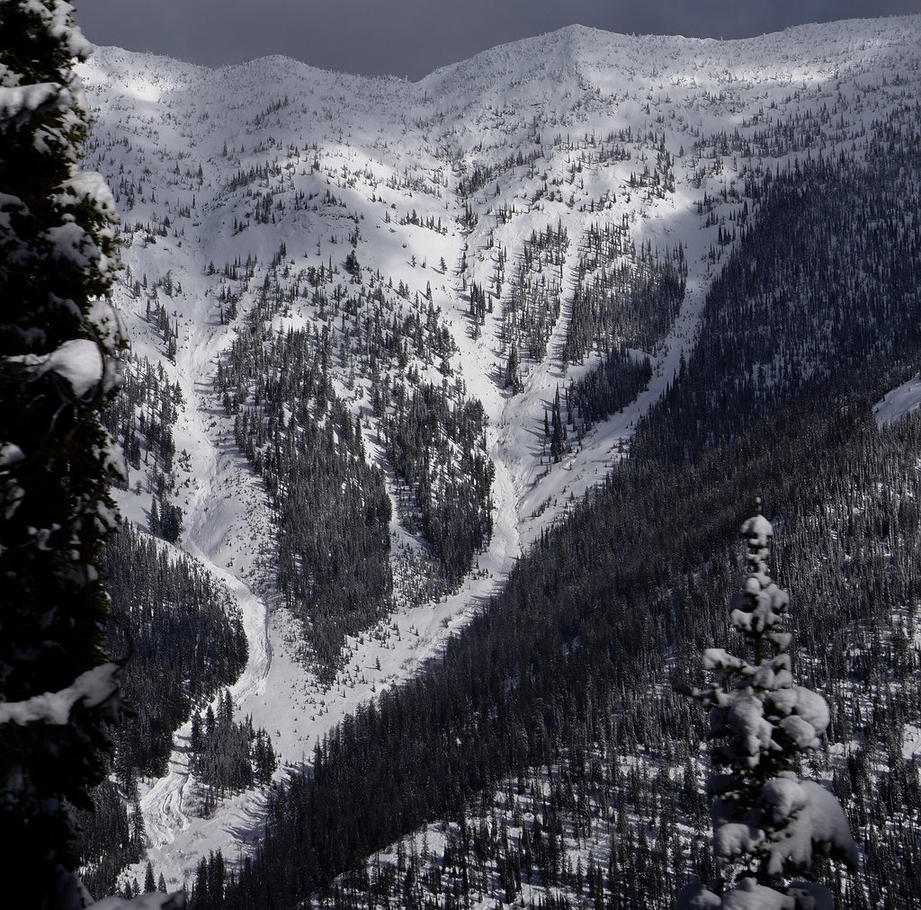 Avalanche on Stryker Ridge in the Upper Whitefish Range. Photo by Grant Hughes with Great Northern Powder Guides.