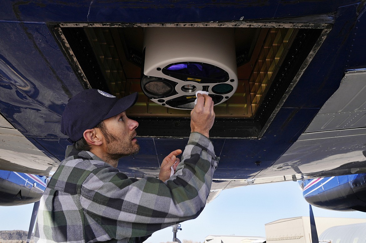
Dan Berisford, an engineer with Airborne Snow Observatories, cleans a laser mapping device used to measure snow that is mounted under an airplane, Monday, April 18, 2022, in Gunnison, Colo. Some drought-prone communities in the U.S. West are mapping snow by air to refine their water forecasts. (AP Photo/Brittany Peterson)
May 4, 2022
Stories this photo appears in:

May 10, 2022 midnight
To refine water forecasts, Western cities map snow by plane
At a tiny airport surrounded by mountains, a three-person crew takes off for the inaugural flight above the headwaters of the Colorado River to measure the region's snow by air.