Crews battling regional wildfires
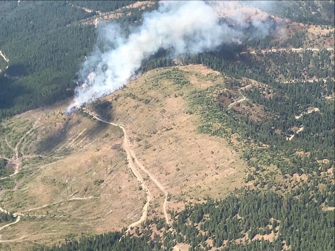
Smoke pours from the Swede Creek Fire in Lincoln County. (U.S. Forest Service photo)
U.S. Forest Service crews are battling four small wildfires in Northwest Montana.
The largest is the 200-acre Garnet Fire in the Bob Marshall Wilderness in Lake County. It is burning on mid to upper slopes on the northeast part of the ridge that separates the Little Salmon and Big Salmon drainages, approximately 4 miles up the drainage from the South Fork of the Flathead River on the west side of Garnet Creek.
According to InciWeb, the fire received 1/10 of an inch of rain Wednesday morning and fire growth has been minimal as a result.
The fire is continuing to spread farther into the Garnet Creek drainage and is anticipated to eventually spot across the creek and establish on the western aspect of the slope.
Protection plans are in process as the fire is anticipated to spread toward the Salmon Forks cabin, located approximately 4 miles east of the current fire location. A crew has been established at the cabin to implement structure protection plans, and supplies are being packed in to Mud Lake Lookout so the historic building can be wrapped in the coming days.
Contacts are being made with individuals recreating in the area of the Little Salmon trails system and closure orders are posted.
There is an official closure order in place for the Little Salmon drainage and some connecting trails.
Due to the emergency nature of the fire, the District Ranger granted special permission for the first fire drone flight to take place on the district Wednesday. The drone was flown by the Spotted Bear Wildland Fire Module Leader (a qualified drone pilot) to identify the exact location of the fire without creating additional risk for personnel.
Current fire behavior is classified as creeping, mainly upslope to the south; currently lateral movement and backing downslope to the Little Salmon Creek bottom is limited. Single tree torching has been observed.
The Lion Creek Fire is listed at 161 acres. Hot and dry daytime conditions and strong nighttime thermal belts have kept the fire active.
Incident Commander Brandon Hightower reported the primary carrier of the fire continues to be heavy dead and downed fuels within an old prescribed fire burn scar from 1996. The fire is burning on a steep southerly aspect and continues to actively spread to the east.
Short uphill runs are hitting the top of the ridge, then backing downslope along the ridgeline to where Lion Creek turns to the north. The ridge is currently keeping the fire from establishing itself to the north. The fire is within a mile of an outfitter camp that is located in the north bowl of Lion Creek. There was a little activity on the west flank of the fire down by the Lion Creek Trail, but otherwise little to no spread west.
The current plan of action is to monitor fire spread particularly to the west down drainage into the valley. Although this is a low probability event, fire managers said they will continue to plan for it.
There are two smaller fires in the Kootenai region.
According to The Western News, Forest Service crews are battling the Swede Creek 30-acre wildfire in the Williams Gulch and Swede Mountain area.
Authorities responded to the scene after an air attack crew spotted smoke about 3:30 p.m. Wednesday. By the day’s end, the Forest Service had about 25 firefighters on scene using engine modules, dozers, a helicopter, an air attack and two single-engine air tankers to battle the blaze.
Swede Mountain Road is closed due to the fire.
Dan Rose, forest fire management officer for the Kootenai National Forest, said effort went into creating a fire line. Rose expected it to be complete by Thursday afternoon.
He described the fire as “low risk at this point in terms of the impact to our local communities.”
While the cause of the blaze remains under investigation, Rose said officials have ruled out lightning.
Crews are also working on a smaller fire, the 14-acre Lightning Peak Fire, near Cow Creek.
The fire is burning east of the Fisher River and south of Wolf Creek. It was spotted Wednesday morning. A cause has not been determined.