Thursday, April 25, 2024
47.0°F

Fire update: Crews attack new blaze north of Whitefish
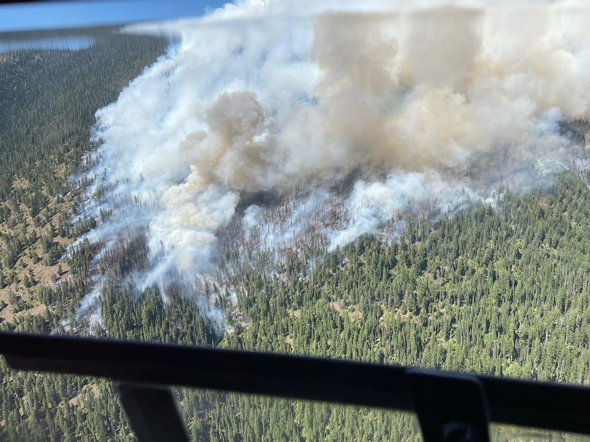
by MATT BALDWIN
Daily Inter Lake | July 24, 2021 8:00 AM

Fire managers ordered a heavy attack on a new fire that cropped up north of Whitefish on Friday evening.

Six engines, four helicopters and an air tanker were sent to the Hemlock Fire in the Whitefish Range just south of Werner Peak and north of Big Mountain. The fire was initially estimated at 35 acres and smoke from the blaze could be seen from the valley. It was listed as 0% contained on Saturday morning.

On the other side of the Whitefish Range, the Hay Creek Fire burning about 5 miles west of Polebridge grew to an estimated 1,006 acres, according to Northern Rockies Coordination Center information on Saturday morning. It was listed as 0% contained.

Fire command transitioned to a Type 3 Incident Management Team on Friday. Pre-evacuation notices were in place for 20 structures in the area.

A community meeting was planned for Saturday at 6 p.m. at the Sondreson Community Hall parking lot.

Road closures due to the fire include portions of Red Meadow and Hay Creek Road. Nearby trail closures are also in place along the Whitefish Divide.

The Flathead National Forest is currently in Stage 1 fire restrictions and will enter Stage 2 fire restrictions on Monday.

ACTIVITY PICKED up Friday on the Burnt Peak Fire on the Kootenai Forest southwest of Troy on the Idaho state line. On Saturday morning it was estimated at 2,242 acres and 19% contained.

The fire continues to spread mainly west, across the slope and up Keeler Creek drainage. Some residences have been placed on pre-evacuation notice.

The South Yaak Fire north of Troy grew to 722 acres, due to strong, gusty winds on Friday. Lincoln County Sheriff’s Office initiated evacuations for all residents living on Kilbrennan Lake Road.

East Side Road and Kilbrennan Lake Cutoff are closed to the junction with Seventeen Mile Road. Local residents are permitted on East Side Road, where there are no evacuations at this time.

ON THE Lolo National Forest, the Thorne Creek Fire was estimated at 3,262 acres on Saturday morning. It is burning 5 miles northeast of Thompson Falls.

Areas under an evacuation warning are from Cougar Creek south to the intersection of Blue Slide Road and the railroad tracks. The Sanders County Sheriff's Office refers to these areas as “Graves North” and “Graves South.”

There will be a community meeting Sunday at 6 p.m. at Ainsworth Park in Thompson Falls.